Skip to content
Reuse radar

Genoa

Genoa has no register of empty buildings, but the City has begun one: on 17 December 2025 the council voted unanimously (31 votes) to map every abandoned public and private space, and in 2026 it published a list of 32 disused sites — ex mills, sheds, ruins and five Port Authority buildings — under regional law 23/2018. The State records 19 buildings as free, among them the Andrea Doria barracks (13,034 m²) and the ex military bakery in Via Rolla (7,404 m²), and on 30 June 2026 the Demanio, Region, City, University, Soprintendenza and Port Authority signed a "Piano Città" for public property. A former psychiatric hospital at Quarto, 24,800 m², is held by a State-owned property fund with its urban plan approved.
Vacant office spaceNot yet measured
Empty buildings on record174and 32 more with an empty shop, flat or floor; of all 206, 41 confirmed
On the map1,328buildings and sites from 12 open sources
Homes potential—not in the economic model’s office data yet

Office figures: No office-vacancy figure for Genoa turned up in the sources read on 9 Oct 2026. Map built 2026-10-09.

The map

Every building a record says stands empty, one point per building: filter by type, size and how sure the evidence is, and open one to see who says so. “Opportunities” switches to the co-op lens: public land, conversion potential and projects already under way, every source as its own layer.

No vacancy register: the council's mapping order of 17 December 2025 has only just been voted, and the 2026 list gives sites, not how long each has stood empty.

Loading map…

0 empty buildings · colour = type, dark ring = confirmed

Check any building in Genoa: could it become homes, and could the EHC model work there?

Named empty by owners and public records

A building that the owner or a public register records as empty — whole buildings of at least 1,500 m² whose plans suit homes on paper (band A in our conversion check), not ruins and not let for interim use. Each row says who records it empty and when. We have not been to them, and a record can be out of date; those we have confirmed empty ourselves are marked as tour stops.

BuildingFloor areaRecorded empty byActions
Ex Panificio militareAs a partner
Former State military bakery, part of the Marabotto compound · Via Francesco Rolla 9 · Agenzia del Demanio (State)
7,404 m²Agenzia del Demanio — Immobili dello Stato (record GE0204001); Comune di Genova, scheda 15
Public register · European Housing Coop research · 9 Oct 2026

Where to look first

Buildings with evidence that they stand empty — a second source agrees, a public record names them, or we have checked them — ranked by a score you can read: co-op scale, daylight depth, a station nearby, a zone that allows homes, affordable land and an open route in. Checked buildings carry their result; nobody has visited them on site yet. Leerstandsmelder reports join the list when they sit in a large non-residential building and a second source agrees.

PriorityBuildingFloor areaDepthStationConversion checkActions
98Edificio scolastico
Public building named vacant · Edificio scolastico (es.: scuola di ogni ordine e grado, università, scuola di formazione) · 4 storeys · 1 other source nearby
4,885 m²10.7 m154 mA fit only
98Edificio scolastico
Public building named vacant · Edificio scolastico (es.: scuola di ogni ordine e grado, università, scuola di formazione) · 1 other source nearby
2,872 m²14.7 m334 mA fit only
98Edificio scolastico
Public building named vacant · Edificio scolastico (es.: scuola di ogni ordine e grado, università, scuola di formazione) · 5 storeys
5,152 m²11.6 m468 mA fit only
98Edificio scolastico
Public building named vacant · Edificio scolastico (es.: scuola di ogni ordine e grado, università, scuola di formazione) · 4 storeys · 2 other sources nearby
3,362 m²14.8 m90 mA fit only
98Edificio scolastico
Public building named vacant · Edificio scolastico (es.: scuola di ogni ordine e grado, università, scuola di formazione) · 2 storeys
2,984 m²12.9 m387 mA fit only
98Edificio scolastico
Public building named vacant · Edificio scolastico (es.: scuola di ogni ordine e grado, università, scuola di formazione) · 1 other source nearby
8,192 m²9.7 m367 mA fit only
92Edificio scolastico
Public building named vacant · Edificio scolastico (es.: scuola di ogni ordine e grado, università, scuola di formazione) · 3 storeys · 1 other source nearby
1,910 m²9.8 m125 mA fit only
91Edificio scolastico
Public building named vacant · Edificio scolastico (es.: scuola di ogni ordine e grado, università, scuola di formazione) · 2 storeys
3,243 m²8.7 m615 mA fit only
90Edificio scolastico
Public building named vacant · Edificio scolastico (es.: scuola di ogni ordine e grado, università, scuola di formazione) · 2 other sources nearby
1,691 m²12.6 m211 mA fit only
88Caserma Vittorio Veneto - Palazzina Ingresso
On public land · Caserma Vittorio Veneto · 6 storeys · 1 other source nearby
5,798 m²12.9 m323 mA fit only

Districts where conversion makes sense

Where empty offices, the right zoning and a working neighbourhood come together — and what could go wrong.

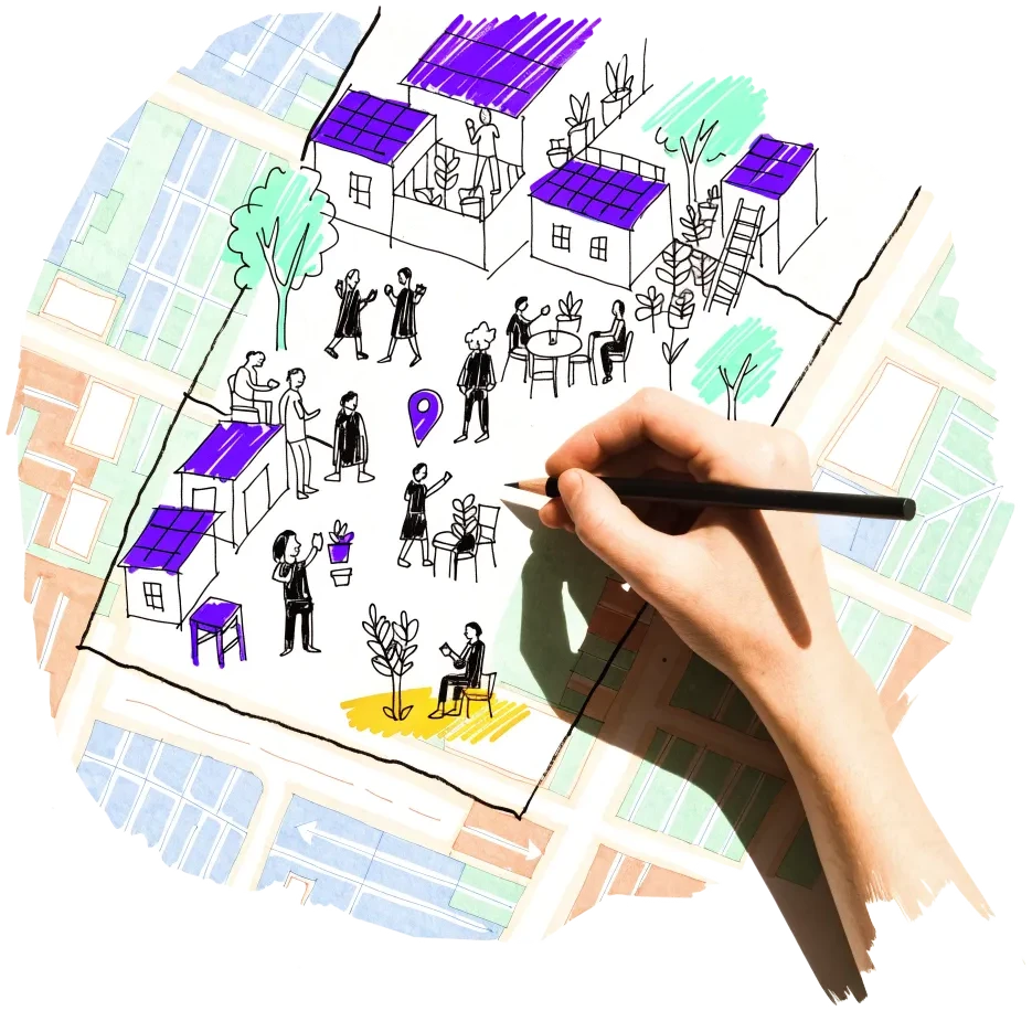
A hand outlining a neighbourhood on a city map, with small houses drawn inside

Voltri, Sestri Ponente and the western valleys

The first fifteen sheets of the City's 2026 list lie in the west: the former ironworks and woollen mill at Via Fratelli Noli 5, the Ireti complex and two ex paper mills in the Cerusa valley, ex cartiera Grillo at Acquasanta, the Janua Algor complex, the Chiaravagna ruins and ex Basital works, and the ex military bakery in Via Rolla (7,404 m², also on the State's free register). The Port Authority's ex Forever building at Voltri adds 821 m².

  • Sheets 1–15 and 32 lie from Voltri to Campi
  • Via delle Fabbriche: two ex paper mills, a ruin and an ex Enel building
  • Ex military bakery, Via Rolla 9: 7,404 m² recorded free by the State

Risk: Valley-floor sites with flood and landslide exposure (the Chiaravagna and Cerusa), industrial soil and long journeys to the centre; the owners of most private sites are not stated.

2 sources

Sampierdarena and the Polcevera valley

Four Port Authority buildings on Via Sampierdarena — from the 943 m² Ex Casa Bertorello to a 173 m² store — and shed complexes along the Polcevera (Via Argine Polcevera, Via Bruzzo, Bolzaneto, Via Sardorella) are on the City list. The Nino Bixio barracks at Bolzaneto has an ex hospital building of 5,084 m² recorded free.

  • Ex Casa Bertorello: 943 m² gross, upper floors partly unsafe
  • Sheet 17: municipal sheds and houses around the Derrick area, Via Bruzzo
  • Via Sardorella 59: ex military hospital building, 5,084 m²

Risk: Flood zones along the Polcevera; industrial soil; many sites are sheds rather than residential buildings.

2 sources

Bisagno valley — Staglieno and Molassana

Seven sheets (20–26) cover shed complexes either side of Via Toti and around the Staglieno cemetery (Via Piacenza), the ex Ricupoil works in Via Lodi and shed and workshop complexes at Rio Maggiore, Isola del Vescovo and Via Geirato.

  • Sheets 20–26 lie along the Bisagno from Staglieno to Molassana
  • Via Lodi 15: ex Ricupoil
  • Via Piacenza: marble-workers area east of the cemetery and sheds to the west

Risk: Narrow valley floor with flood exposure along the Bisagno; mostly small industrial plots.

1 source

Quarto and the eastern hills

The former psychiatric hospital at Via Maggio 6 is the largest single block: 24,786 m² gross on a 55,000 m² plot in a residential quarter, with a planning convention for housing, offices, hotels and services already signed. Ex Forte Ratti (8,403 m²) and the Forte Richelieu batteries sit above it.

  • PUO approved 20 October 2017, convention signed 17 October 2018
  • Partly occupied: the nurses' house and some outdoor areas
  • Ex Forte Ratti: 8,403 m² gross on the investor portal

Risk: Heritage-listed main building and a fund owner; the fund's fact sheet is undated, so the current state of the scheme is unknown.

2 sources

Owners and routes in

Who controls the space, and what a housing cooperative can actually do with them.

A door key on a doorstep with a drawn path leading to an open door
Public owner

Agenzia del Demanio and the Piano Città of 30 June 2026

The Agency, Region, City, Metropolitan City, University, Soprintendenza and Port Authority signed the "Piano Città degli immobili pubblici di Genova" at the University on 30 June 2026. The Port Authority put two buildings in its first portfolio: the Ex Casa Bertorello (public-use services, private activities, neighbourhood shops) and a Motorizzazione Civile building. A co-op can propose a use on a building the Plan names or on a State building the register records as free.

1 source
Allocation rule

Comune di Genova — mapping order and the regeneration list

On 17 December 2025 the council asked the Giunta to survey abandoned public and private spaces and then draft a regeneration plan, with priority for the most urgent areas, to be funded in later budget changes. The 2026 list of 32 sites under regional law 23/2018 is the first output; a co-op can approach the owners of the listed sites (the Ireti group for the Val Cerusa complex, the Port Authority for the five State-domain sheets) and ask the City to prioritise a site.

2 sources
Public owner

CDP Real Asset SGR — Ex Ospedale Psichiatrico di Quarto

A State-owned property fund (CDP) holds the building with an approved urban plan and planning convention; it presents a single reuse scheme, with residential parts allowed. A co-op could be a partner or buyer for a residential part, though the scale (24,800 m²) suits a consortium.

1 source

Signals to watch

Decisions, auctions and closures that change what becomes available, and when.

  1. 2026-08
    City publishes its list of disused buildings for reuse

    32 numbered sheets under regional law 23/2018: 27 for private and municipal sites, 5 for Port Authority State-domain buildings with gross areas.

    1 source
  2. 2026-06-30
    Piano Città degli immobili pubblici di Genova signed

    Demanio, Region, City, Metropolitan City, University, Soprintendenza and Port Authority agree to rationalise public seats and reuse disused buildings; the Port Authority adds the Ex Casa Bertorello and a Motorizzazione Civile building.

    1 source
  3. 2025-12-17
    Council votes unanimously to map abandoned spaces

    Order of the day 63 to the 2026–2028 budget: survey public and private abandoned spaces, then a regeneration plan; 31 votes in favour.

    1 source

Sources and freshness

21 sources connected, 1 waiting for access. We only use data we may lawfully reuse; where a publisher blocks automated access we do not work around it — a person downloads it, or we ask for permission.

Show every source, its licence and when we last read it
SourceAccessRecordsStatusLicence
OpenStreetMap disused/abandoned tags and brownfields
OpenStreetMap contributors
Open API209Live
2026-10-09
ODbL 1.0 (© OpenStreetMap contributors)
Rail, S-Bahn and U-Bahn stations (OpenStreetMap)
OpenStreetMap contributors
Open APIscoringLive
2026-10-09
ODbL 1.0 (© OpenStreetMap contributors)
Building heights: GlobalBuildingAtlas (TU Munich)
Zhu, X. X., Chen, S., Zhang, F., Shi, Y., Wang, Y. (2025), Technical University of Munich
GlobalBuildingAtlas: an open global and complete dataset of building polygons, heights and LoD1 3D models. Earth System Science Data 17(12), 6647–6668, doi:10.5194/essd-17-6647-2025. Read from the Parquet copy on Source Cooperative. Satellite-derived heights (typically 1.5–3 m error in Europe), turned into storeys with storey heights fitted on Berlin; used only where no register or official 3D model sizes the building.
Open download102 buildings sizedLive
2026-10-09
CC BY-NC 4.0 (heights); footprints from OpenStreetMap and Microsoft: ODbL
Road noise (EU Environmental Noise Directive, Lden)
European Environment Agency
Open APIscoringLive
2026-10-09
EEA standard re-use policy (attribution)
Leerstandsmelder.de — public reports of empty buildings
Leerstandsmelder (Gängeviertel e.V., Hamburg)
Shown while we ask Leerstandsmelder for permission. Reports since 2016 only, with the address, the month reported and a link to each entry; not checked by EHC. Each point says when a report has since been marked demolished, lived in, in interim use or rebuilt on Leerstandsmelder, and the owner type the reporter gave (private owners are never named).
Asking for permission0Pending
2026-10-09
Credited to Leerstandsmelder.de; asking for permission
Open-ended property funds: buildings they report partly empty
Open-ended real-estate funds (each point names its fund and report)
German and Austrian open-ended public property funds must list every property with its vacancy (or letting) rate in their annual and half-year reports. scripts/reuse/import-fund-reports.ts reads those lists; properties at 10 % vacancy or more are shown, those at 25 % or more count as evidence.
Open download0Live
2026-10-09
Published fund report (KAGB / KARBV property list), cited per point
Co-working spaces, department stores, banks, hotels and cinemas listed as permanently closed
Overture Maps Foundation (closure data: BrightQuery company records)
Places with operating_status "permanently_closed" in the monthly Overture release, read by scripts/reuse/import-overture-closures.ts and matched to the building they sit in. A closed business is usually one unit; names are shown only for companies, never for sole traders.
Open download0Live
2026-10-09
CDLA Permissive 2.0 (Overture Maps Foundation)
Land without current use and stalled construction, mapped from satellite imagery (Copernicus Urban Atlas 2006–2018)
European Environment Agency — Copernicus Land Monitoring Service
Urban Atlas class 13400 (brownfields, demolition sites and gaps in the built-up area, 0.25 ha and up) compared across the 2006, 2012 and 2018 editions, so each plot says how long it has stood unused; plus construction sites (13300) already under way in 2012, and 2012 construction sites left unused by 2018. Read from the EEA's open ArcGIS services, the same way in every radar city. The 2021 edition (Copernicus Data Space) drops plots built on since 2018 where scripts/reuse/import-urban-atlas-2021.ts has been run. Points are context, never evidence of vacancy.
Open API56Live
2026-10-09
Copernicus open data (© European Union, Copernicus Land Monitoring Service 2006–2021, EEA)
Office buildings of 1,000 m² or more, with depth and storeys (EUBUCCO)
EUBUCCO (TU Berlin / ai4up), from the Spanish cadastre, Regione Lombardia’s building database and OpenStreetMap
EUBUCCO harmonises Europe's building footprints with their use, height and age. Only buildings whose source names the use are kept — the cadastre's office class in Barcelona and Madrid, Lombardy's "commerciale" in Milan, building=office in OpenStreetMap for Dublin and Lisbon — never EUBUCCO's machine-learning guesses. The footprint gives the plan depth, so the conversion score treats them like the German cadastre's offices (scripts/reuse/import-eubucco.ts → src/scripts/data/reuse/eubucco/, ODbL).
Open download0Live
2026-10-09
ODbL 1.0 (EUBUCCO v0.2; Dirección General del Catastro, Regione Lombardia, © OpenStreetMap contributors)
Stalled construction and buildings held by insolvent developers
EHC research (dated press and court sources per point)
Signa, Adler/Consus and other developer insolvencies since 2022 and stalled sites, each with its latest dated status (src/scripts/data/reuse/stalled-projects.json; news leads from scripts/reuse/mine-news.ts are reviewed before they join).
EHC research0Live
2026-10-09
Cited publisher per point
Church buildings the dioceses and regional churches plan to give up
Catholic dioceses and Protestant regional churches (their building plans), via EHC research
Buildings a church body’s published building plan or recent reporting names as to be given up, without church funding, for sale or lease, or profaned (src/scripts/data/reuse/church-plans.json and brussels-churches.json).
EHC research0Live
2026-10-09
Cited publisher per point
Named buildings and sites from EHC research (each with its own source)
European Housing Coop research
EHC research6Live
2026-10-09
Facts cited to their publishers
Year built and listing: OpenStreetMap building tags
OpenStreetMap contributors
start_date / construction_date and heritage / listed_status of the OpenStreetMap outline a record is matched to, where no register answers. Read with the outline match, not a separate query.
Open APIscoringLive
2026-10-09
ODbL 1.0 (© OpenStreetMap contributors)
State buildings recorded as free (Agenzia del Demanio)
Agenzia del Demanio — Geoportale, Immobili dello Stato
Open API19Live
2026-10-09
No licence stated on the map service — credited to Agenzia del Demanio (its open-data files are CC BY 3.0 IT); shown under the 6 Oct 2026 licence decision
State-owned buildings of 1,000 m² or more in use (Agenzia del Demanio)
Agenzia del Demanio — Geoportale, Immobili dello Stato
Open API92Live
2026-10-09
No licence stated on the map service — credited to Agenzia del Demanio (its open-data files are CC BY 3.0 IT); shown under the 6 Oct 2026 licence decision
State buildings offered to investors (Agenzia del Demanio, Portale Investitori)
Agenzia del Demanio — Crea valore, investi con noi (investor portal)
Open API5Live
2026-10-09
No licence stated on the map service — credited to Agenzia del Demanio (its open-data files are CC BY 3.0 IT); shown under the 6 Oct 2026 licence decision
Disused buildings and sites listed by the City of Genoa for reuse (regional law 23/2018)
Comune di Genova — Area Sviluppo del Territorio, Direzione Pianificazione: "Ambiti di rigenerazione urbana per il riuso e il recupero funzionale del patrimonio immobiliare dismesso" (art. 2 and 4 L.R. 23/2018; art. 23-quater DPR 380/2001)
Manual download32Snapshot
2026-10-09
Public council document, no licence stated — credited to the City of Genoa
Ruins in the regional topographic database (Regione Liguria, DB Topografico 1:25,000)
Regione Liguria — DB Topografico regionale 1:25,000 (derived from the Carta Tecnica Regionale 2007/13, updated from 2013 orthophotos)
Open API112Live
2026-10-09
Regione Liguria open geodata — the regional INSPIRE records of related layers cite CC BY 4.0; this layer's own licence line was not read, credited to Regione Liguria
Public buildings their owner records as not used (Treasury property census 2022)
Ministero dell'Economia e delle Finanze, Dipartimento dell'Economia — Rilevazione dei beni immobili delle amministrazioni pubbliche (data at 31 Dec 2022)
Manual download115Snapshot
2026-10-09
CC BY 4.0 (stated on the MEF open-data page; reuse with the source credited)
Public flats, shops and stores their owner records as not used (Treasury property census 2022)
Ministero dell'Economia e delle Finanze, Dipartimento dell'Economia — Rilevazione dei beni immobili delle amministrazioni pubbliche (data at 31 Dec 2022)
Manual download636Snapshot
2026-10-09
CC BY 4.0 (stated on the MEF open-data page; reuse with the source credited)
OpenStreetMap: land mapped as brownfield
OpenStreetMap contributors
Open API44Live
2026-10-09
ODbL 1.0
Cultural heritage in danger in Genoa — Italia Nostra's Lista Rossa
Italia Nostra APS — Lista Rossa dei beni culturali in pericolo
Open API2Live
2026-10-09
© Italia Nostra APS, no licence stated — only the name, the street, the list status and a link are kept (no descriptions or photos); credited to Italia Nostra

What this radar cannot see yet

  • No vacancy register: the council's mapping order of 17 December 2025 has only just been voted, and the 2026 list gives sites, not how long each has stood empty.
  • The City's open-data portal lists only 32 historic municipal buildings offered to the city in April 2015 (CC BY 4.0) — a property offer, not a vacancy list; not mapped.
  • ANBSC's confiscated-property export (openregio.anbsc.it) answered HTTP 504 on every request on 9 Oct 2026, so the confiscated-property layer is missing.
  • The regional topographic database maps 112 ruins inside the city as bare points with no area, mostly rural; no open building layer with heights was found, so floor areas come from the Global Building Atlas.
  • The Soprintendenza's press release for the Piano Città (full first portfolio) could not be opened (connection refused on 9 Oct 2026); only the Port Authority's two buildings are confirmed.

Know an empty building we have missed?

Open data cannot see everything. Tell us about a building in Genoa that stands empty or barely used; once we have checked it, it joins the map under “Reported by visitors (checked)”.

A phone held up to photograph an empty shopfront, with a map pin drawn above it

We publish the address, the kind of building and your description once we have checked it — never your email. Please do not name the people who own or live in a building.

Radars nearby

The other radars in the same country and the nearest beyond. All 134 cities in the atlas

The figure on each card: empty buildings on record.