AI-Generated Summary
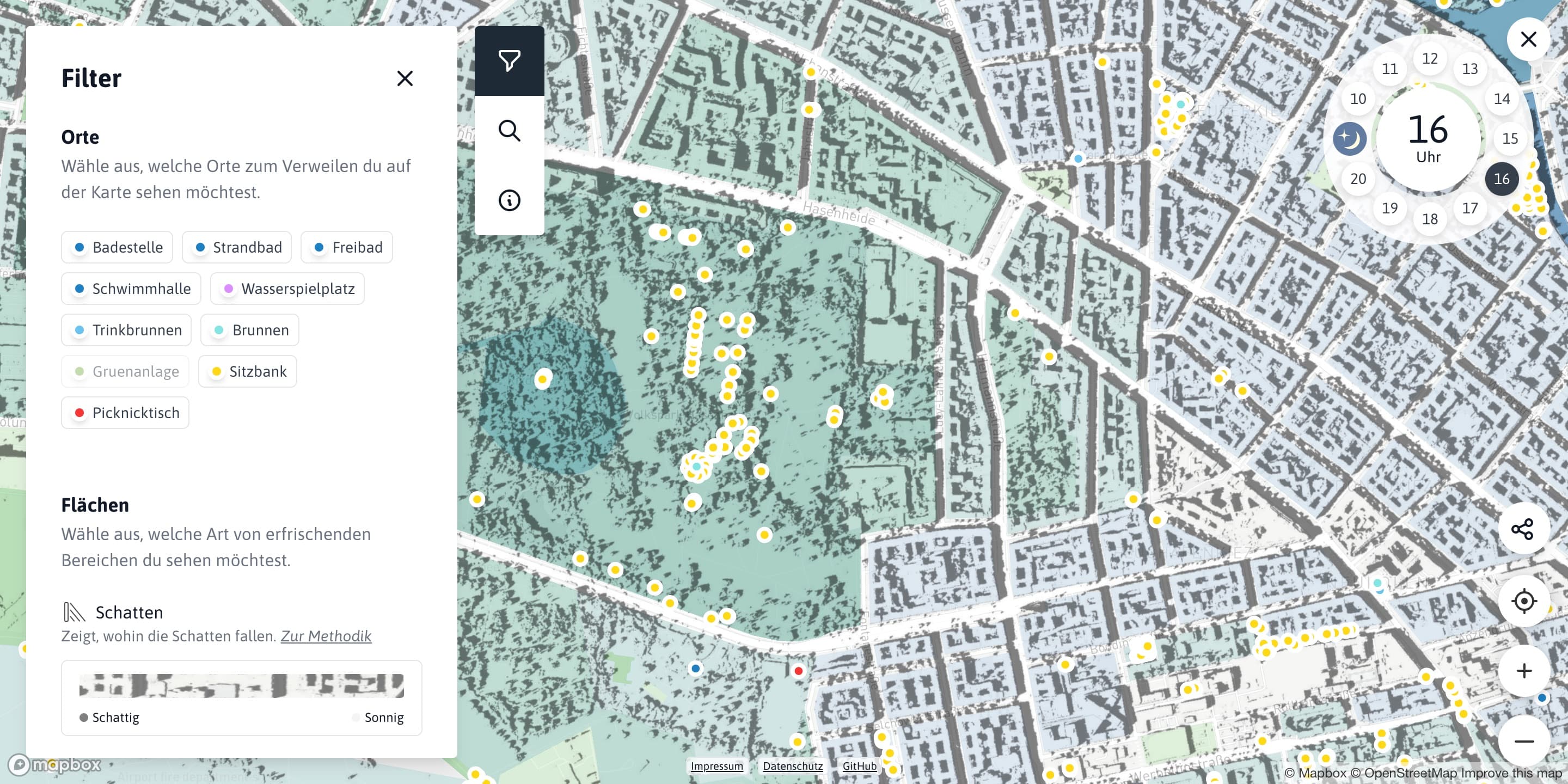
The Berliner Erfrischungskarte (Berlin Refreshment Map) is an interactive digital map developed by Technologiestiftung Berlin and CityLAB Berlin that helps residents and visitors find cool and refreshing places across the city during periods of extreme heat. The map categorises cooling locations including parks and green spaces, water features such as lakes and public fountains, air-conditioned public buildings like libraries and museums, shaded seating areas, drinking water fountains, and bathing spots. Users can filter by category and access details about opening hours and accessibility. The tool integrates data from Berlin's Environmental Atlas, OpenStreetMap, the Berlin Open Data Portal, and citizen contributions to provide a comprehensive picture of the city's cooling infrastructure. It draws on urban climate modelling that assesses the cooling capacity of green and blue infrastructure. The Erfrischungskarte is part of Berlin's broader climate adaptation strategy, complementing the Climate Neutrality Roadmap, Stadtgrün Berlin green space programmes, and municipal heat action plans. It is built on open-source technologies, aligning with Berlin's Gemeinsam Digital smart city strategy and enabling other cities to adapt the tool. Similar heat resilience mapping initiatives exist in Vienna, Paris, Athens, and Barcelona. The project demonstrates how open data, urban climate science, and user-centred design can combine to create practical tools that improve quality of life during extreme weather, serving as a model for integrating smart city technology with public health goals.